オーストラリア・ニュージーランドの鉄道を紹介します!
AUandNZ Railfan
Australia and New Zealand Railfan
ブリスベンメトロ M1 & M2
Brisbane Metro M1 & M2
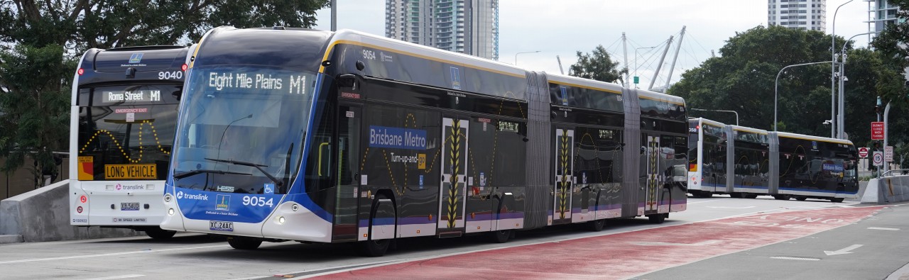
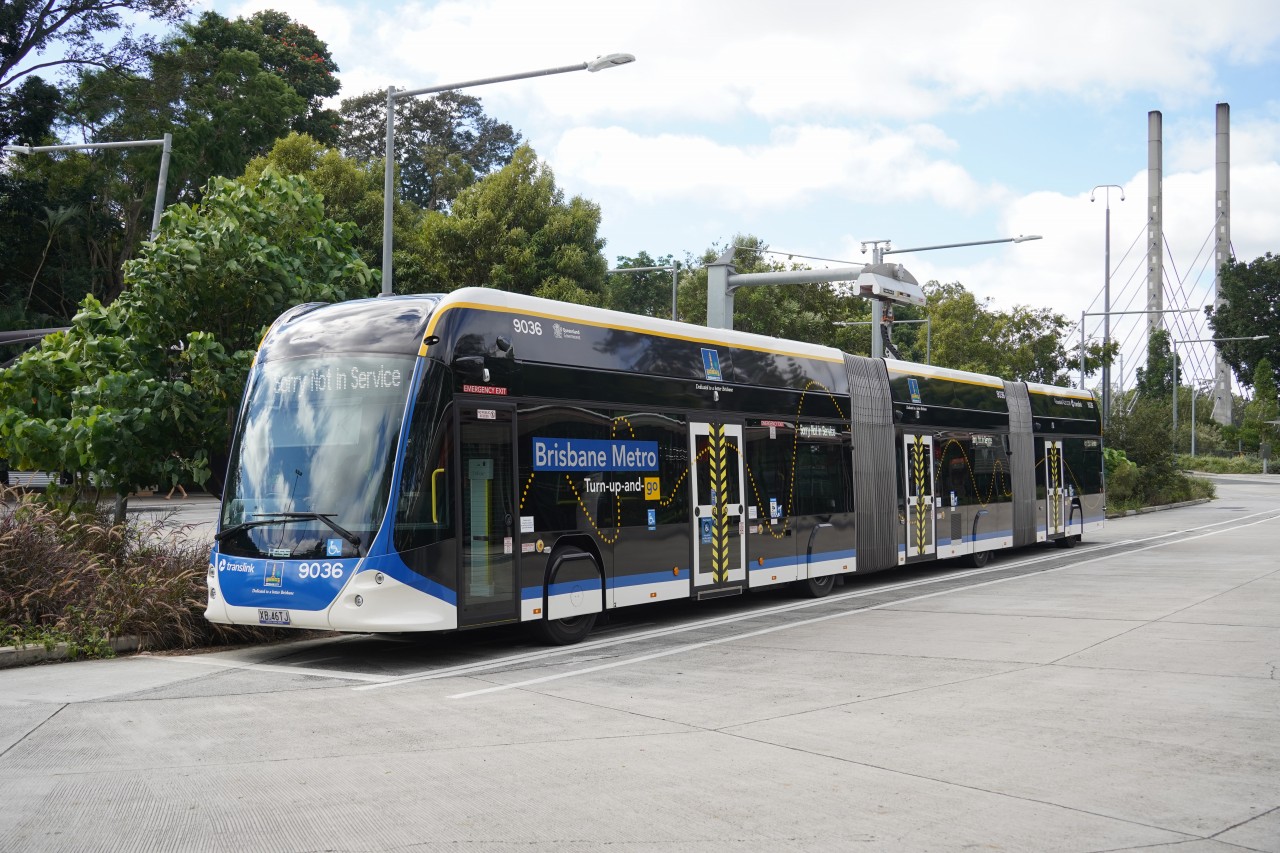
Brisbane Metro is a high-frequency public transport system operating in Brisbane, Australia. Using dedicated busways, its two routes, M1 and M2, provide fast and frequent connections across the city. The system uses modern electric buses and offers an environmentally friendly and sustainable transport service.
ブリスベンメトロは、ブリスベン市の公共交通機関の輸送力向上を目的として計画され、2024年に運行を開始しました。
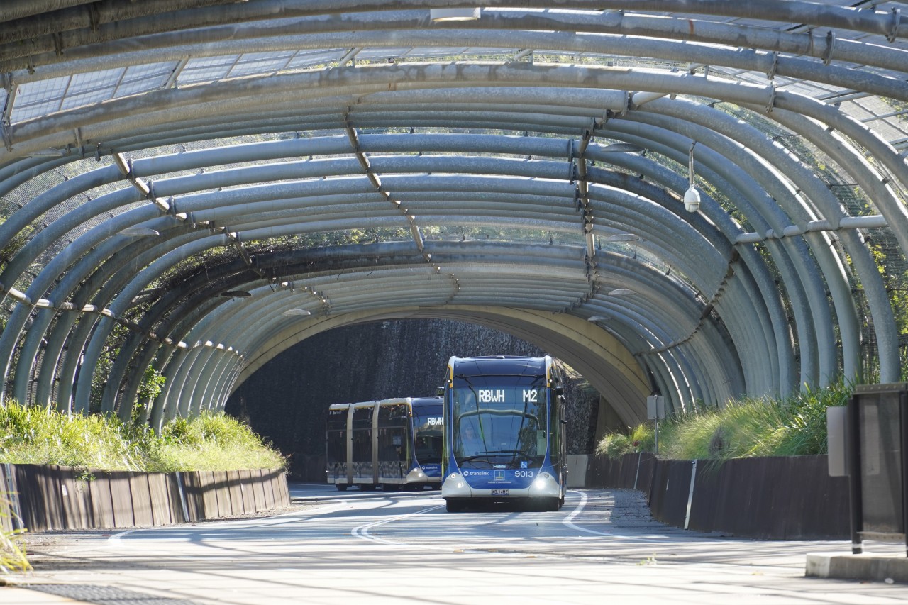
名称に「Metro」が含まれていますが鉄道ではなく、専用バスウェイを走行する大容量の電気連節バスによるバス高速輸送システム(BRT)です。
既存のバスウェイ網を活用することで、鉄道建設より低コストかつ短期間で整備されました。
Brisbane Metro was developed to increase the capacity of Brisbane's public transport network and entered service in 2024. Despite its name, it is not a railway or light rail system. Instead, it is a Bus Rapid Transit (BRT) system using high-capacity electric articulated buses operating on dedicated busways. By utilising Brisbane's existing busway network, the system was delivered more quickly and at a lower cost than building a new rail line.
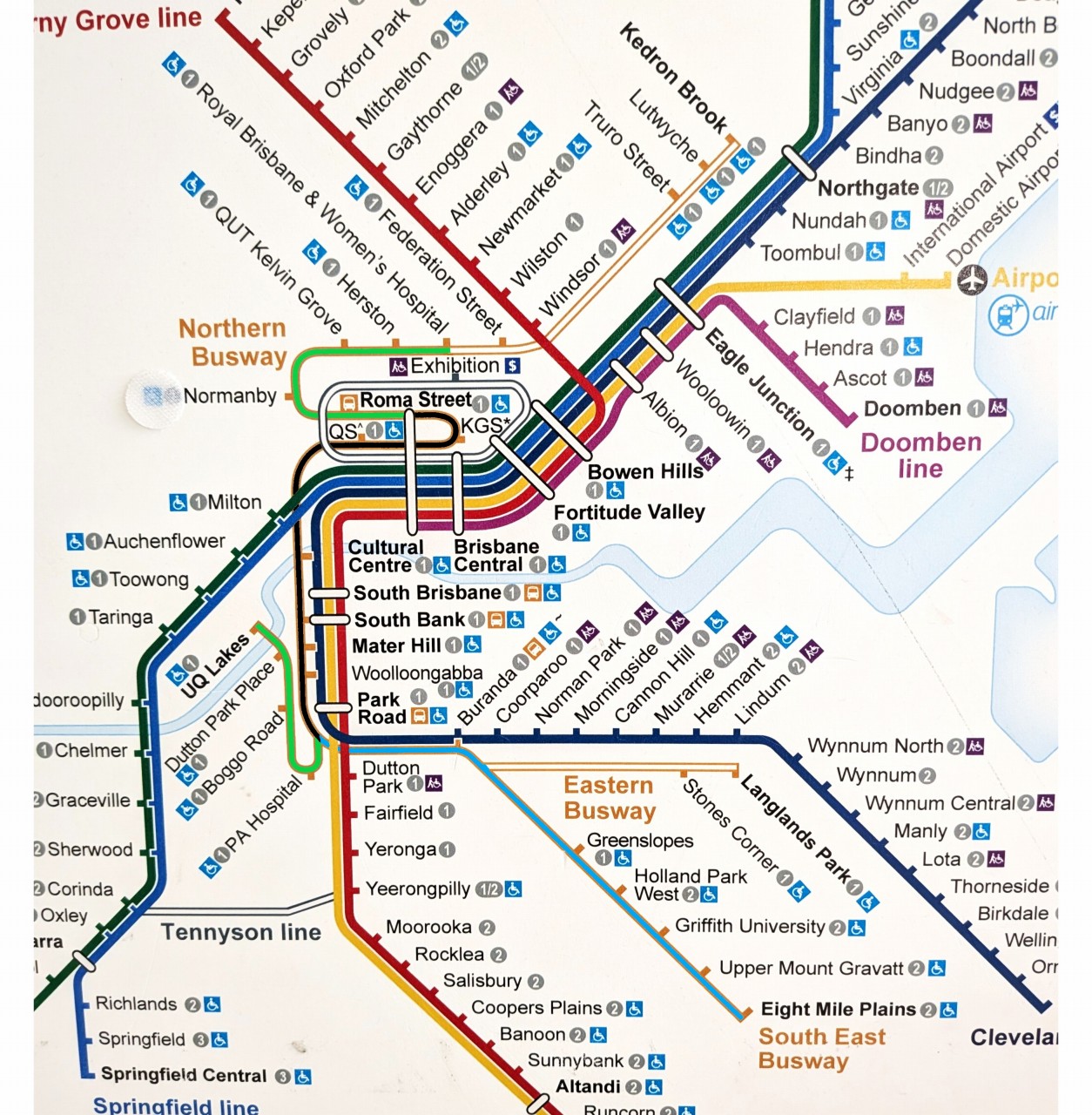
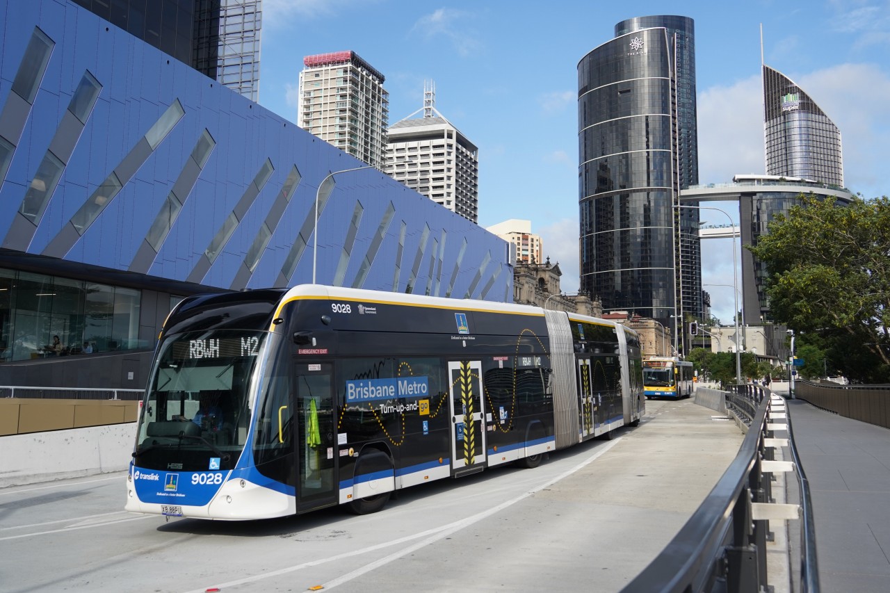
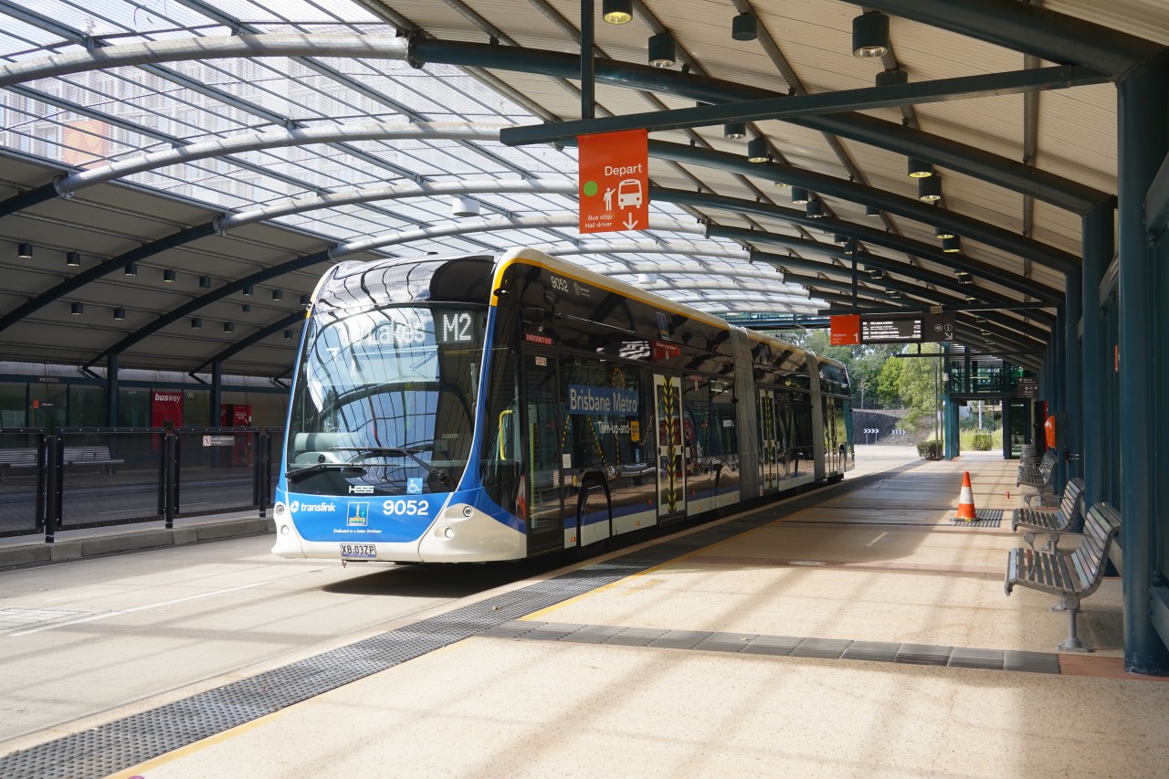
ブリスベンメトロは現在、M1とM2の2路線で運行されています。両路線とも市内中心部のバスウェイを経由し、高頻度で運転されています。
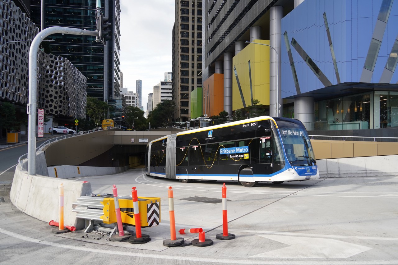
M1はEight Mile PlainsとRoma Streetを結び、ブリスベン南東部から都心への主要なアクセスルートとなっています。
M2はUniversity of Queensland(UQ)とRoyal Brisbane & Women's Hospital(RBWH)を結び、教育機関や医療機関へのアクセスを担っています。
上記の路線図では、M1とM2の共用区間を黒色、M1のみが走行する区間を水色、M2のみが走行する区間を黄緑色で表示しています。
Brisbane Metro currently operates two routes, M1 and M2. Both services use the city's dedicated busway network and provide frequent connections through central Brisbane.
M1 links Eight Mile Plains with Roma Street, providing a major transport corridor between Brisbane's south-eastern suburbs and the city centre.
M2 connects the University of Queensland (UQ) with the Royal Brisbane & Women's Hospital (RBWH), serving important education and healthcare destinations.
In the route map shown above, sections used by both M1 and M2 are highlighted in black, M1-only sections in light blue, and M2-only sections in light green.
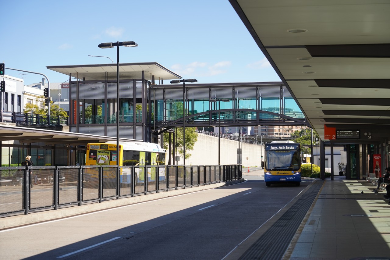
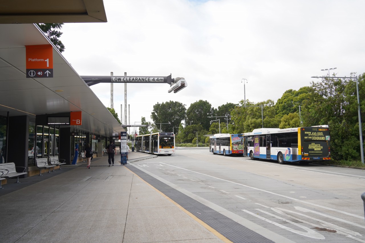
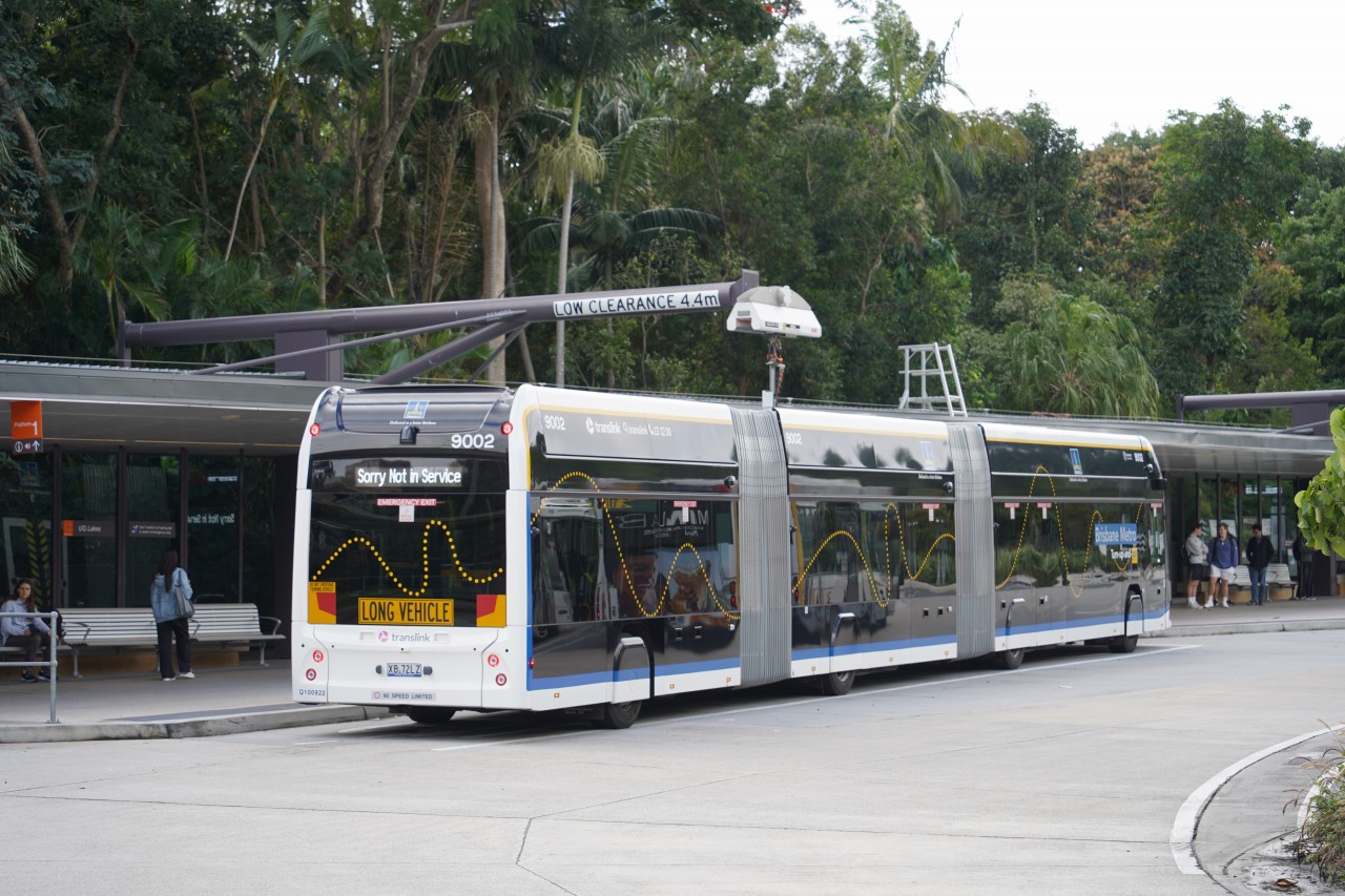
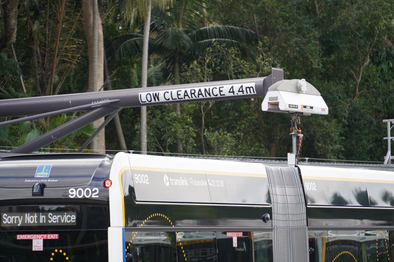
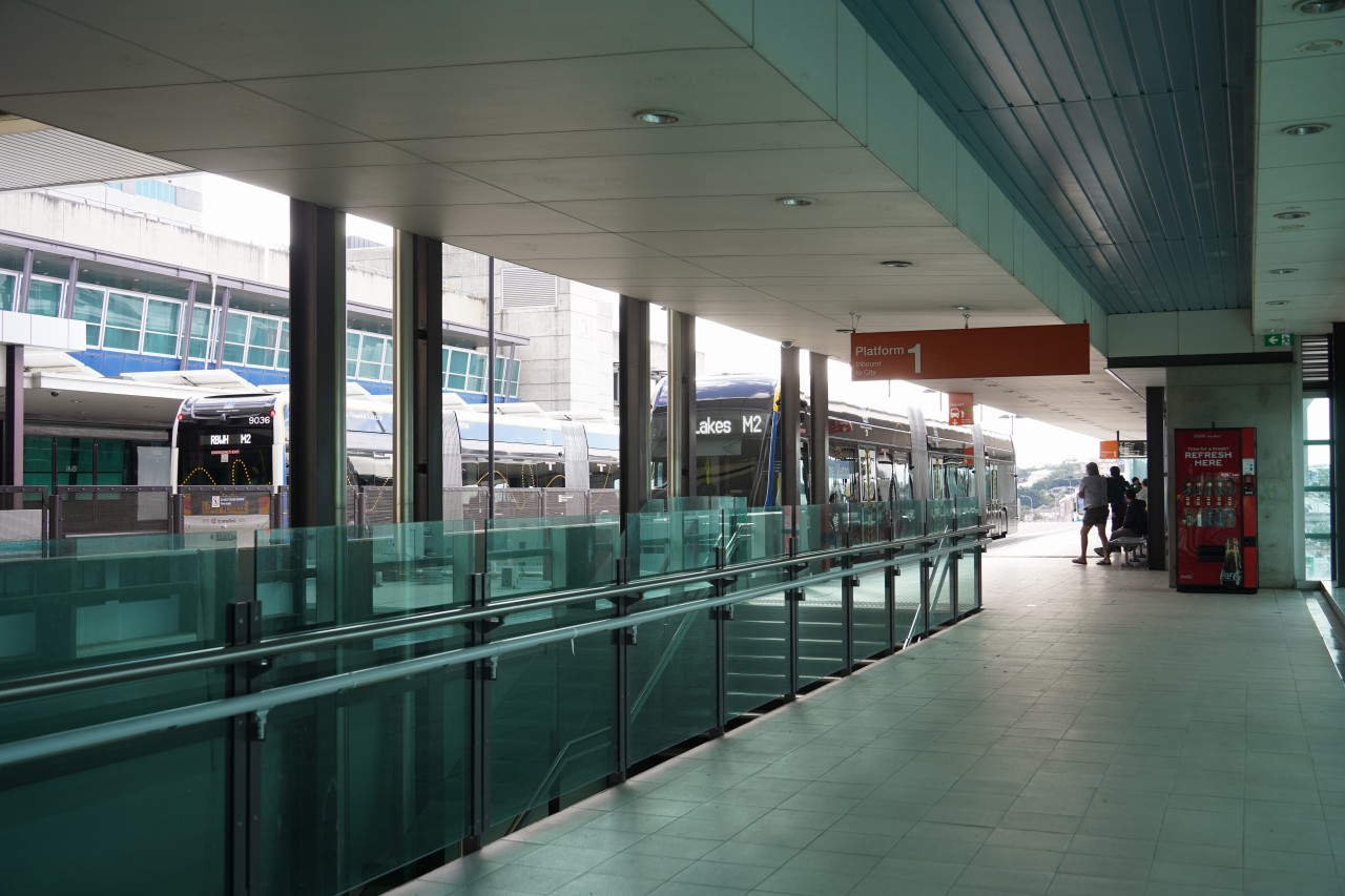
Roma Street Busway Station(ローマストリート・バスウェイ駅)は、ブリスベン中心部に位置する主要な公共交通拠点です。隣接するRoma Street駅では鉄道や長距離列車に接続しており、ブリスベン有数の乗換駅となっています。
ブリスベンメトロでは、M1の起点・終点となる駅であり、多くの利用者がここで市内中心部や郊外方面へ移動します。一方、M2はRoma Streetを経由するものの終点ではなく、その先のRoyal Brisbane & Women's Hospital(RBWH)まで運行されています。
駅はサウスイースト・バスウェイとインナーノーザン・バスウェイを結ぶ重要な位置にあり、ブリスベンのバスネットワークの中核を担っています。
Roma Street Busway Station is a major public transport hub located in central Brisbane. It is adjacent to Roma Street railway station, providing convenient connections with suburban, regional and long-distance rail services.
For Brisbane Metro, Roma Street serves as the terminus of the M1 route, with services starting and ending here. The M2 route also passes through Roma Street, but it continues beyond the station to Royal Brisbane & Women's Hospital (RBWH) and does not terminate here.
The station occupies a strategic position linking the South East Busway and the Inner Northern Busway, making it one of the most important interchange points in Brisbane's public transport network.
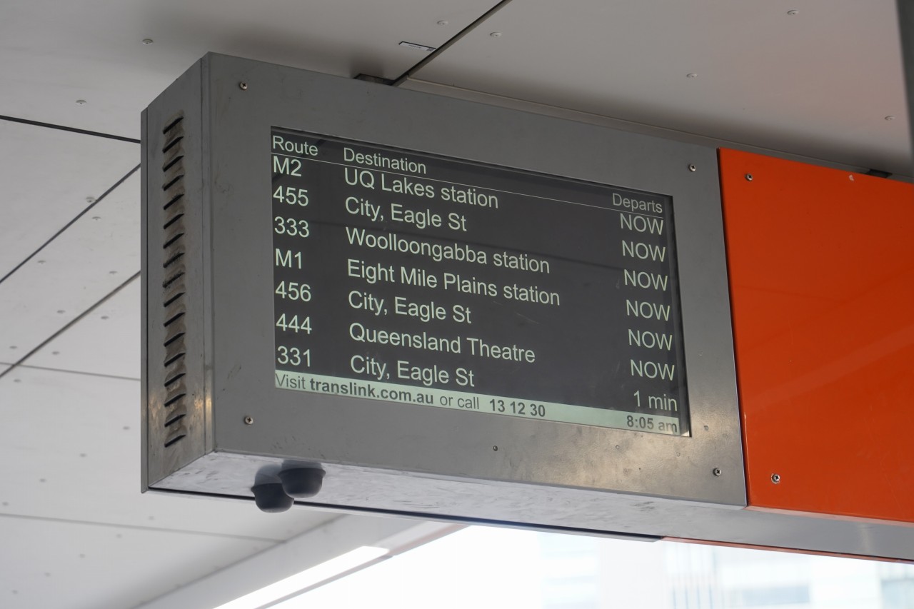
Roma Street Busway Stationの発車案内表示には、次に発車するバスやブリスベンメトロの行先と発車までの時間が表示されています。通常は利用者が発車時刻を確認するための案内設備ですが、ラッシュ時には非常に多くの便が運行されるため、表示画面には画像のように「NOW」が並ぶこともあります。そのため、どの便が次に発車するのか一目では分からないほどの高頻度運転が行われています。
ブリスベンのバスウェイは世界でも有数の高輸送力BRTとして知られ、ピーク時には最短約12秒間隔でバスが運行されます。これは1時間あたり最大約300便に相当し、鉄道に匹敵する輸送能力を実現しています。Roma Street Busway Stationでは、この高頻度運転を支えるため複数の乗り場と効率的な運行管理システムが整備されています。
The departure information displays at Roma Street Busway Station show the destination and departure time of upcoming Brisbane Metro and bus services. Under normal conditions, passengers can easily see which service is leaving next and how many minutes remain before departure. During peak periods, however, services operate so frequently that the display can be filled with "NOW" indicators, as shown in the image. At such times, departures are so close together that it can be difficult to determine which vehicle will leave first.
Brisbane's busway network is one of the highest-capacity Bus Rapid Transit (BRT) systems in the world. During peak periods, buses can operate at intervals of as little as 12 seconds, equivalent to approximately 300 services per hour. This level of frequency rivals many urban rail systems and demonstrates the remarkable carrying capacity of Brisbane's dedicated busway infrastructure.
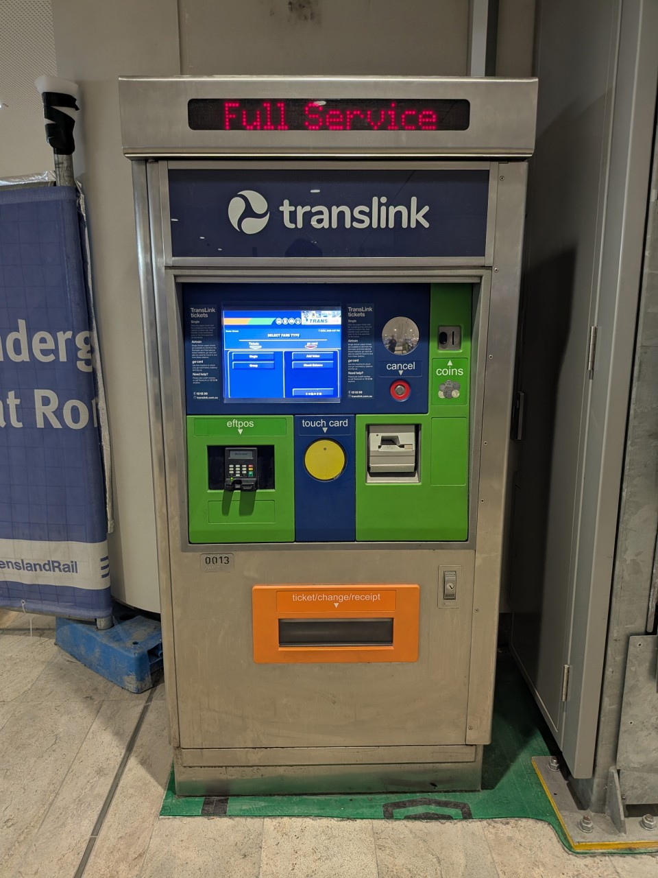
Roma Street駅構内には鉄道とバスで共用する券売機が設置されています。しかし、ブリスベン有数のターミナル駅でありながら券売機はわずか1台しかありません。日本では考えにくい設備規模ですが、これはオーストラリアのキャッシュレス化が非常に進んでいることを反映しています。
ブリスベンでは現地の交通系ICカード「go card」に加え、VisaやMastercardなどのクレジットカードやデビットカードによるタッチ決済がそのまま利用できます。さらに、これらのタッチ決済でもgo cardと同様に50セント均一運賃が適用されるため、多くの利用者は券売機を利用する必要がありません。
そのため紙の乗車券を購入する利用者は非常に少なく、主要ターミナル駅であるRoma Streetでさえ券売機1台で十分対応できています。
券売機の少なさは、オーストラリアにおける公共交通機関のキャッシュレス化の進展を象徴する光景といえるでしょう。
A shared ticket vending machine for both rail and bus services is provided at Roma Street Station. However, despite being one of Brisbane's major transport hubs, there is only a single ticket machine available. While this may seem surprising by Japanese standards, it reflects Australia's highly cashless society.
In Brisbane, passengers can travel using the local "go card" smartcard or simply tap a Visa, Mastercard, or other supported contactless payment card. These contactless bank card payments receive the same 50-cent flat fare as go card users, eliminating the need to purchase paper tickets for most journeys.
As a result, demand for paper tickets is extremely low, and even a major terminal such as Roma Street can operate with just one ticket vending machine. The small number of ticket machines serves as a visible example of how extensively cashless payment has been adopted across Australia's public transport system.
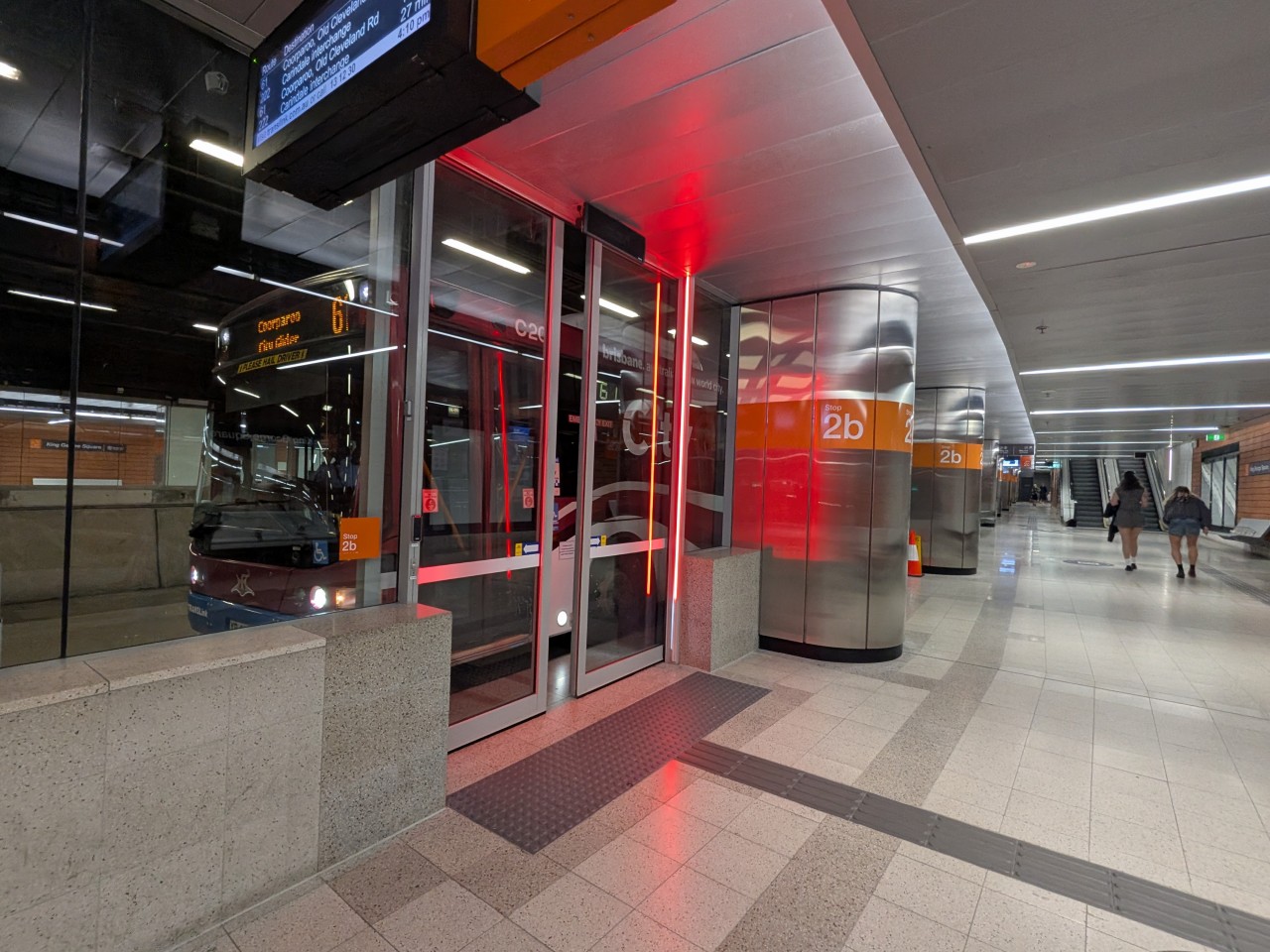
King George Square Busway Station(キングジョージスクエア駅)は、ブリスベン中心部に位置するバスウェイ駅です。
ブリスベンメトロでは唯一の地下駅であり、安全対策としてホームにはフルスクリーンドアが設置されています。
BRT(バス高速輸送システム)でありながら、地下駅とホームドアを備える点は鉄道の地下鉄駅にも似た特徴となっています。
King George Square Busway Station is located in the heart of Brisbane's city centre.
It is the only underground station on the Brisbane Metro network and is equipped with full-height platform screen doors for passenger safety.
Despite being part of a Bus Rapid Transit (BRT) system, its underground platforms and screen doors give it a similar appearance to a modern metro station.
King George Square駅を発車したブリスベンメトロは、ブリスベン川を渡るため地下区間から地上へ上がります。
この区間には比較的急な勾配があり、鉄道では運行上の制約となるような坂道ですが、ゴムタイヤで走行するブリスベンメトロや路線バスにとっては大きな問題ではありません。
After departing King George Square Station, Brisbane Metro vehicles climb from the underground section to the surface in order to cross the Brisbane River.
This section features a relatively steep gradient that would be challenging for many railway systems. However, because Brisbane Metro operates on rubber tyres, the incline presents no significant operational difficulties.

Cultural Centre Station(カルチャルセンター駅)は、サウスバンク地区に位置するバスウェイ駅です。ブリスベンメトロのM1・M2の両路線が停車し、多数の路線バスとの乗り換え拠点となっています。
駅周辺には美術館や博物館、劇場などの文化施設が集まっており、ブリスベンを代表する観光エリアへの玄関口としても利用されています。
画像奥に見える橋は、ブリスベン川を渡るVictoria Bridge(ビクトリア橋)です。現在はバスウェイと歩行者・自転車専用の橋として使用されており、ブリスベン中心部とサウスバンクを結ぶ重要な交通ルートとなっています。
Cultural Centre Station is a busway station located in the South Bank precinct. It is served by both Brisbane Metro routes, M1 and M2, and acts as an important interchange with many bus services.
The station provides convenient access to Brisbane's major cultural attractions, including museums, galleries and theatres.
The bridge visible in the background is Victoria Bridge, which crosses the Brisbane River. It is now reserved for buses, Brisbane Metro services, pedestrians and cyclists, providing an important link between the city centre and South Bank.
ブリスベンのバスウェイは鉄道とは異なり、多くの地点で一般道路へ分岐できる構造となっています。そのため、ほとんどの系統はバスウェイを走行した後に一般道路へ出て各方面へ向かい、路線全体を通してバスウェイのみを走る系統は存在しません。
ブリスベンメトロのM1は主にサウスイースト・バスウェイを走行しますが、画像のWoolloongabba(ウールルーンガーバ)駅は本線からわずかに分岐した位置にあるバス駅のため、M1は停車せず通過します。
また、Woolloongabbaでは現在、地下鉄道新線であるCross River Railの新駅建設が進められており、2032年のブリスベンオリンピックに向けて重要な交通拠点となる予定です。新駅の開業後は利用者の流れが変化することが予想され、将来的にはバスウェイやブリスベンメトロの路線・運行系統が再編されることもあるかもしれません。
Unlike railways, Brisbane's busway network has numerous junctions where buses can leave the dedicated busway and continue on ordinary streets. As a result, most routes use the busway for part of their journey before branching off, and no route operates entirely on busway infrastructure from end to end.
Brisbane Metro's M1 primarily uses the South East Busway. However, the Woolloongabba station shown in the image is located on a short branch off the main busway, so M1 does not serve this station.
Woolloongabba is also set to become a major transport hub with the future opening of a new station on the Cross River Rail underground railway project ahead of the Brisbane 2032 Olympic Games. Once the new station opens, travel patterns may change, and the busway and Brisbane Metro network may also be reorganised in the future.
M1が走行するサウスイースト・バスウェイの途中では、イースタン・バスウェイが分岐しています。西側はM2が発着するUQ Lakes方面へ、東側はLanglands Park(ラングランズパーク)までバスウェイが整備されています。
現在、ラングランズパークから先は222系統が一般道路を経由してCarindale(カリンデール)まで運行されています。カリンデール方面はかつてブリスベン市電の主要ルートのひとつであったことから、将来的にバスウェイをカリンデールまで延伸し、222系統をブリスベンメトロの新系統として運行する構想もあるようです。
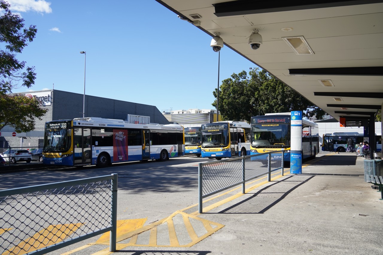
画像はカリンデール・バスターミナルです。多数の路線バスが発着するブリスベン東部の主要な交通拠点であり、将来のバスウェイ延伸計画においても重要な役割を担うと考えられています。
The Eastern Busway branches off from the South East Busway used by M1. To the west, it connects towards UQ Lakes, the western terminus of M2, while to the east, dedicated busway infrastructure currently extends as far as Langlands Park.
Beyond Langlands Park, route 222 continues on ordinary roads to Carindale. As the Carindale corridor was once one of Brisbane's major tram routes, there have been proposals to extend the busway to Carindale and potentially convert route 222 into a future Brisbane Metro service.
The image shows Carindale Bus Terminal. It is a major public transport hub in Brisbane's eastern suburbs and could play an important role in any future expansion of the busway network.
Griffith University Station(グリフィスユニバーシティ駅)は、ブリスベン南部のネイサン地区にあるバスウェイ駅です。駅名の通り、Griffith University のネイサンキャンパス最寄り駅として多くの学生や教職員に利用されています。
駅はサウスイースト・バスウェイ上に位置し、ブリスベンメトロM1をはじめ多数の路線バスが発着します。大学へのアクセスだけでなく、周辺住宅地から市内への通勤・通学輸送も担う重要な駅となっています。
また、この駅からバスウェイを離れて一般道路へ向かう路線も多数設定されており、ブリスベンのバスウェイネットワークにおける重要な分岐点のひとつとなっています。
Griffith University Station is a busway station located in the Nathan area of southern Brisbane. As its name suggests, it serves as the main public transport gateway to Griffith University's Nathan campus and is heavily used by students and staff.
The station is situated on the South East Busway and is served by Brisbane Metro M1 as well as numerous bus routes. In addition to university traffic, it plays an important role in connecting surrounding residential areas with Brisbane's city centre.
Many bus routes also leave the busway at this point and continue along ordinary roads, making the station one of the key branching points within Brisbane's busway network.
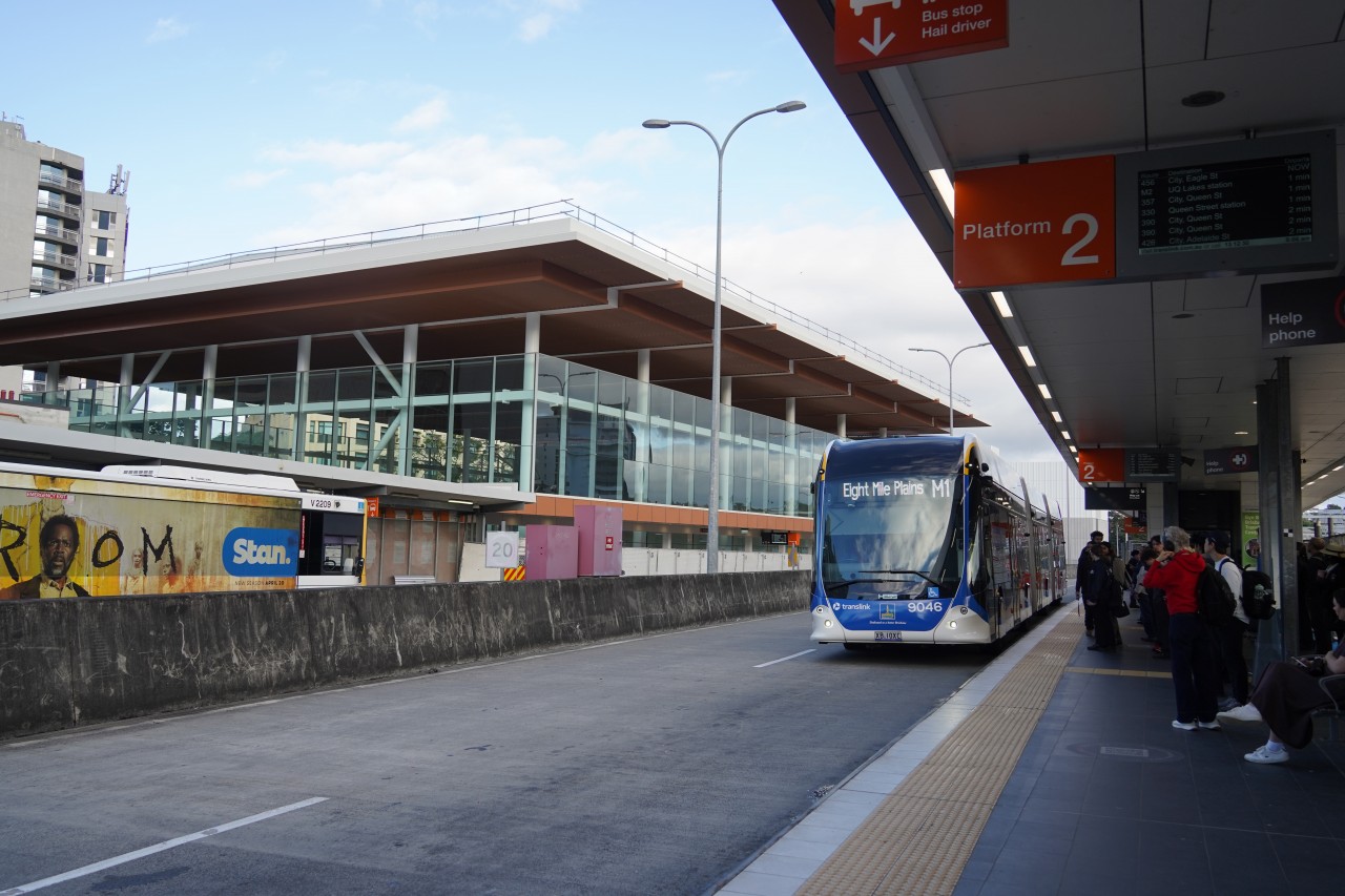
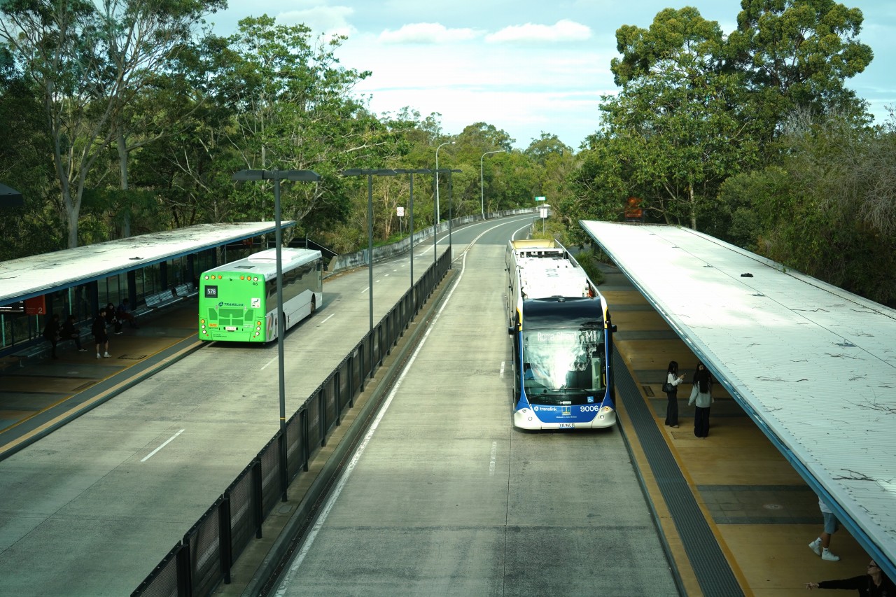
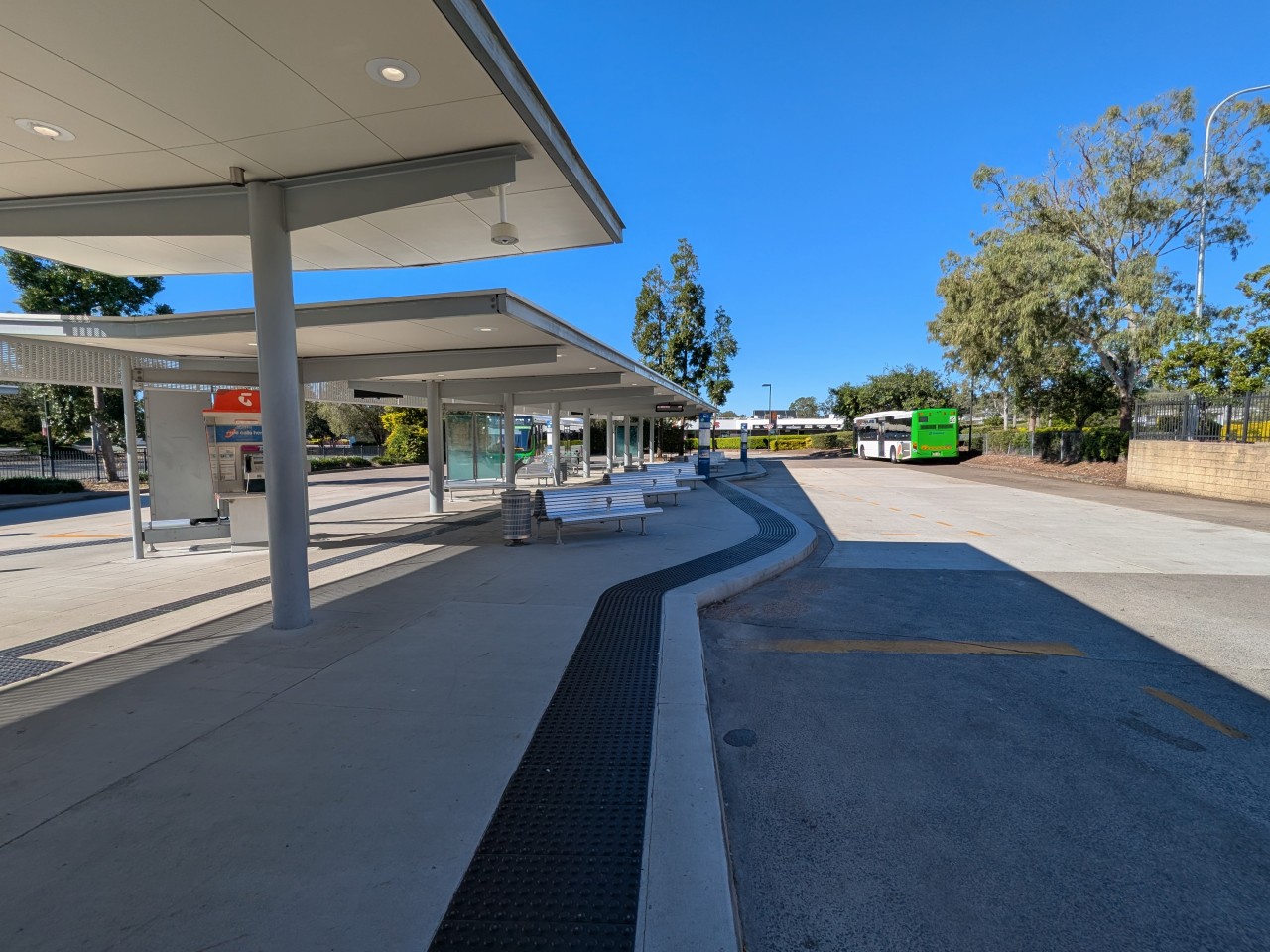
Eight Mile Plains Station(エイトマイルプレーンズ駅)は、サウスイースト・バスウェイの南端に位置する主要なバスウェイ駅です。パークアンドライド駐車場やバスターミナルを備えており、ブリスベン南部やローガン方面からの利用者が多く集まります。
ブリスベンメトロM1は現在、この駅を南側の終点として運行されています。そのため、多くの利用者がここで一般路線バスとブリスベンメトロを乗り継いで移動しています。
駅はサウスイースト・バスウェイの重要な結節点であり、ブリスベン都心方面へ向かう多数のバス路線が発着しています。将来的にブリスベンメトロがさらに南へ延伸される可能性もありますが、現在のところエイトマイルプレーンズ駅がメトロの運行区間の南端となっています。
Eight Mile Plains Station is a major busway station located at the southern end of the South East Busway. Equipped with a large park-and-ride facility and bus terminal, it serves passengers travelling from Brisbane's southern suburbs and the Logan region.
At present, this station is the southern terminus of Brisbane Metro route M1. Many passengers transfer here between Brisbane Metro services and conventional bus routes.
The station is an important transport hub on the South East Busway, with numerous services operating towards Brisbane's city centre. While Brisbane Metro may be extended further south in the future, Eight Mile Plains currently marks the southern limit of the system.
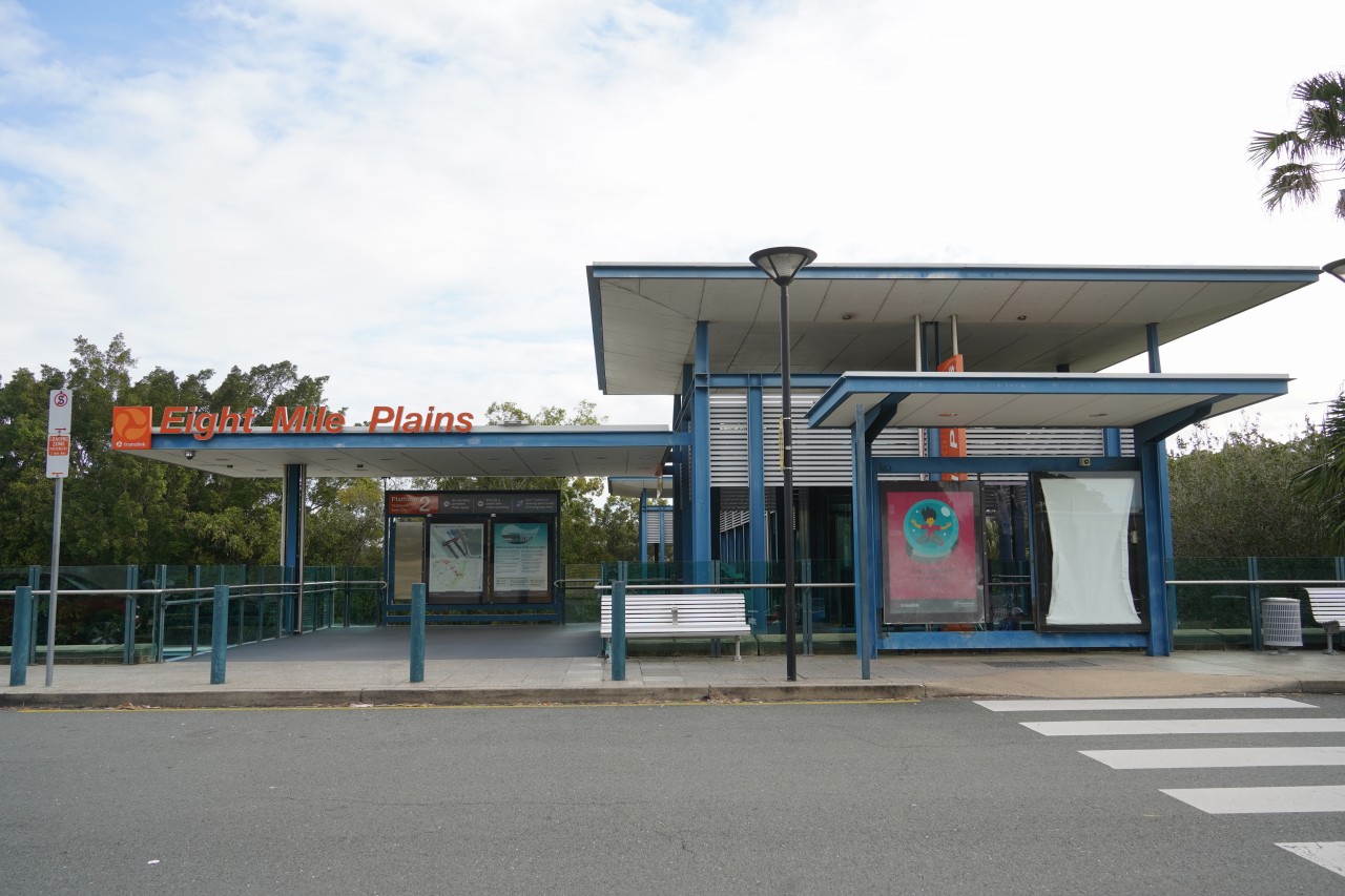
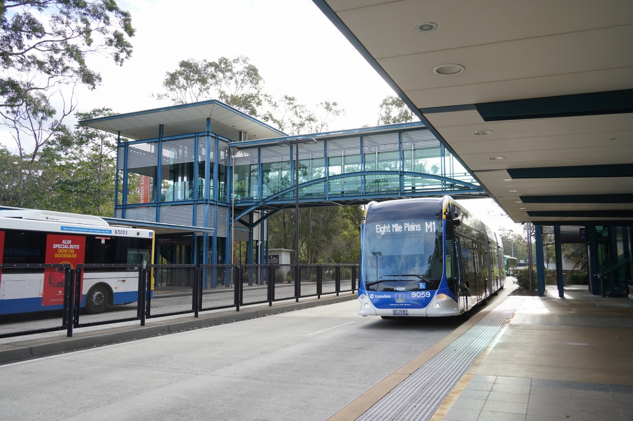
画像はEight Mile Plains Station(エイトマイルプレーンズ駅)の外観です。駅は高速道路(Pacific Motorway)に隣接した場所に立地しており、自動車と公共交通を結ぶ交通結節点として整備されています。
駅には大規模なパークアンドライド駐車場が併設されており、周辺地域の利用者は自家用車で駅まで来て、ブリスベンメトロや路線バスに乗り換えることができます。このような施設は郊外部のバスウェイ駅に多く見られ、都心部への自動車流入を抑える役割も担っています。
The image shows the exterior of Eight Mile Plains Station. The station is located alongside the Pacific Motorway, making it an important interchange between private vehicles and public transport.
A large park-and-ride facility is provided at the station, allowing passengers to drive to the station and transfer to Brisbane Metro or bus services.
Eight Mile Plains駅からRoma Street駅までを走行するブリスベンメトロM1の4K前面展望です。
サウスイースト・バスウェイを通り、郊外から都心へ向かう走行シーンとともに、電気バスならではの静かな走行音も楽しめます。
Brisbane Metro M1 4K front view from Eight Mile Plains to Roma Street, running along the South East Busway from suburbs to the city centre, featuring the quiet sound of electric bus operation.
エイトマイルプレーンズ駅は現在のブリスベンメトロM1の終点ですが、バスウェイ自体はさらに南へ続いています。Roma StreetからEight Mile Plainsまでのサウスイースト・バスウェイ区間は約16kmあり、ブリスベンの公共交通の大動脈として機能しています。
サウスイースト・バスウェイはその後さらに南へ延伸され、2025年にはSpringwood(スプリングウッド)まで到達しました。現在、Roma StreetからSpringwoodまで約25kmにわたって専用バスウェイが整備されています。
さらに将来はLoganholme(ローガンホーム)方面への延伸も計画されており、実現すればブリスベン南東部の公共交通ネットワークがさらに強化されることになります。
現在、ブリスベン市内とローガンホーム方面を結ぶ主要路線として555系統が運行されていますが、将来的にバスウェイの延伸やブリスベンメトロ網の拡大が進めば、この区間がブリスベンメトロとして運行されるようになる可能性もありそうです。
画像は将来の延伸先として計画されているローガンホーム駅です。
Eight Mile Plains is currently the southern terminus of Brisbane Metro M1, but the busway itself continues beyond the station. The South East Busway between Roma Street and Eight Mile Plains is approximately 16 km long and forms one of Brisbane's most important public transport corridors.
The busway was further extended south and reached Springwood in 2025. Today, dedicated busway infrastructure extends for approximately 25 km from Roma Street to Springwood.
Further extensions towards Loganholme are also planned, which would further strengthen public transport connections in Brisbane's southern and south-eastern suburbs.
Route 555 currently provides a major link between Brisbane's city centre and Loganholme. If future busway extensions and Brisbane Metro network expansion proceed, it seems possible that this corridor could eventually become part of the Brisbane Metro network.
The image shows Loganholme Station, which is planned to become the future southern extension of the busway.
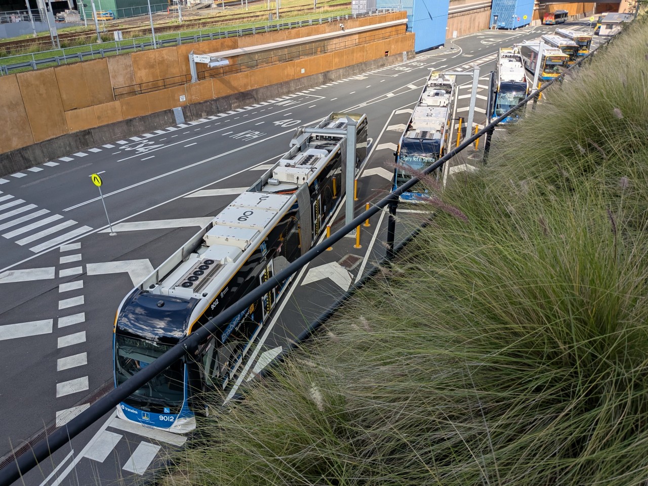
リスベンメトロM1の終点であるEight Mile Plains駅やRoma Street駅には電気バス用の充電設備が設置されていません。そのため、M1の車両は営業運転を終えてRoma Street駅に到着した後、そのまま回送列車のようにノーザン・バスウェイ区間へ移動します。
ブリスベンメトロの運行開始に合わせて、Roma Street駅の北側にあるノーザン・バスウェイ沿線には専用の充電設備が新設されました。M1の電気バスはここで急速充電を行い、再び営業運転に戻ります。
There are no charging facilities for Brisbane Metro electric buses at either Eight Mile Plains or Roma Street, the current termini of route M1. After completing passenger service at Roma Street, vehicles continue out of service along the Northern Busway.
To support Brisbane Metro operations, dedicated charging facilities were constructed on the Northern Busway north of Roma Street. M1 vehicles travel there for recharging before returning to passenger service.
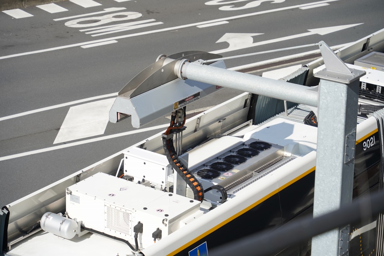
画像はRoma Street駅の北側に設けられたブリスベンメトロ車両基地の充電設備です。ブリスベンメトロの電気バスは営業運転を終えるとここへ回送され、充電を行います。
充電時には車両の屋根からパンタグラフが上昇し、架線側の設備と接続されます。その様子は路面電車やトロリーバスのようにも見え、一般的な電気バスの充電方式とは異なる特徴的な光景となっています。
The image shows the charging facility at the Brisbane Metro depot located north of Roma Street Station. After completing passenger service, Brisbane Metro vehicles travel here for recharging.
During charging, a pantograph mounted on the roof of the vehicle rises and connects to the overhead charging equipment. The process resembles a tram or trolleybus drawing power from overhead infrastructure, creating a distinctive sight compared with conventional electric bus charging systems.
UQ Lakes Station(UQレイクス駅)は、The University of Queensland のセントルシアキャンパス内にあるバスウェイ駅です。ブリスベンメトロM2の西側の終点であり、多くの学生や教職員に利用されています。
駅はRoma Street駅から約6kmの位置にあり、ブリスベン中心部と大学を短時間で結んでいます。M2の開業により、市内中心部やRBWH方面へのアクセスがさらに便利になりました。
UQ Lakes Station is a busway station located within the St Lucia campus of The University of Queensland. It serves as the western terminus of Brisbane Metro route M2 and is heavily used by students and university staff.
The station is located approximately 6 km from Roma Street Station, providing a fast and convenient connection between the university and Brisbane's city centre. The introduction of M2 has further improved access to the CBD and RBWH.
UQ Lakes駅には、ブリスベンメトロ車両用の急速充電設備が設置されています。
終点に到着した車両は屋根上のパンタグラフを使用して充電を行います。
充電設備は利用者からも見やすい場所にあり、電気バスが充電される様子を間近で観察できます。
UQ Lakes Station is equipped with a fast-charging facility for Brisbane Metro vehicles.
After arriving at the terminus, vehicles recharge using a roof-mounted pantograph.
The charging equipment is located in clear view of passengers, allowing the charging process to be observed at close range.
UQ Lakesでの充電風景と、ブリスベンメトロ M2系統、UQ LakesからRBWHまでの全区間前面展望です。
車内では、日本では学校のチャイムとして親しまれているメロディーの原曲であるイギリス・ウェストミンスター宮殿(ビッグ・ベン)の鐘「ウェストミンスター・チャイム」をモチーフにした特徴的なドアチャイムが流れます。
途中で通過するKing George Square停留所の近くには、ブリスベンを代表する建築物であるBrisbane City Hallがあり、その時計塔でもウェストミンスター・チャイムが鳴り響きます。ブリスベンメトロのドアチャイムは、この街のシンボルを感じさせる演出の一つとなっています。
Experience a full 4K front view journey aboard Brisbane Metro M2 in Brisbane, Queensland, Australia, travelling from UQ Lakes to RBWH via the city's dedicated busway.
One of the Metro's most distinctive features is its Westminster Chime door sound. While many people know this melody as a school bell, it actually originated from the famous clock tower of the Palace of Westminster (Big Ben) in London.
The route passes King George Square in the heart of Brisbane, beside the iconic Brisbane City Hall, whose clock tower also plays the Westminster Chime. As one of Brisbane's best-known landmarks, the Metro's door chime reflects a sound that has become part of the city's identity.
Enjoy Australia's newest electric metro bus system, featuring a smooth and quiet ride, dedicated busways and spectacular views through central Brisbane.
UQ Lakes駅を出たM2はイースタン・バスウェイを走行し、サウスイースト・バスウェイへ合流してCultural CentreやRoma Street方面へ向かいます。
Roma Street駅から北側ではM2のみが運行されていますが、ブリスベンメトロ専用区間ではなく、インナーノーザン・バスウェイには多数の一般路線バスも走行しています。
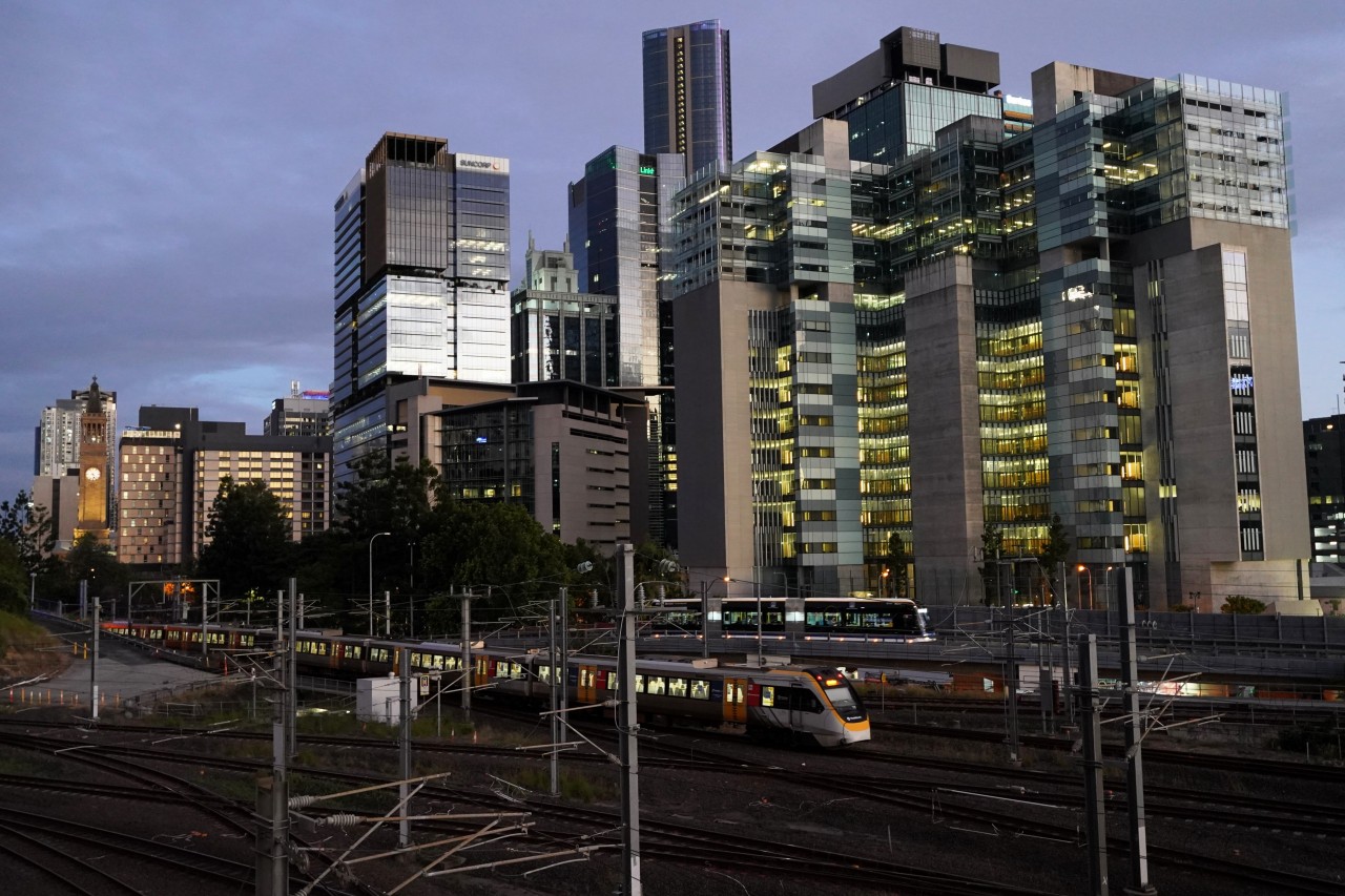
Roma Street駅を出ると、バスウェイはしばらくの間Citytrainの回送線に沿って進みます。鉄道路線と並走する区間では、ブリスベンメトロの電気バスとCitytrainの車両を同時に見ることができます。
After leaving UQ Lakes, M2 operates along the Eastern Busway before joining the South East Busway towards Cultural Centre and Roma Street.
North of Roma Street, M2 is the only Brisbane Metro route in service. However, the Inner Northern Busway is also used by many conventional bus routes and is not exclusive to Brisbane Metro.
Shortly after departing Roma Street, the busway runs alongside Citytrain's non-passenger railway tracks. This section provides opportunities to see Brisbane Metro vehicles operating alongside Citytrain rolling stock.
Normanby Station(ノーマンビー駅)は、インナーノーザン・バスウェイにある駅で、ブリスベンメトロM2と多数の路線バスが停車します。Roma Street駅の北側に位置し、市内中心部と北部郊外を結ぶ重要なバスウェイ駅のひとつです。
駅周辺にはブリスベン・ショーグラウンドやスポーツ施設があり、イベント開催時には多くの利用者で賑わいます。
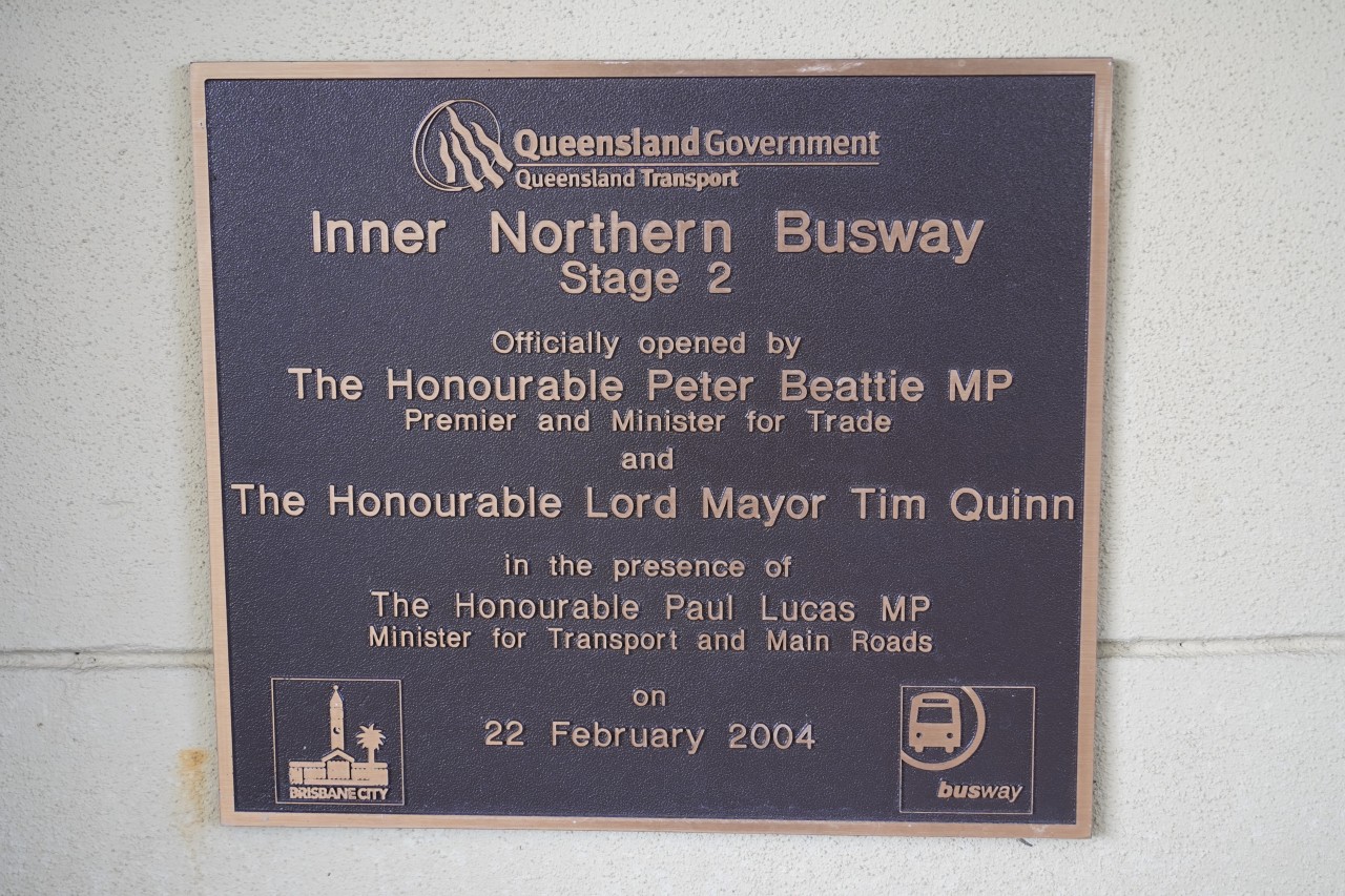
また、駅構内にはインナーノーザン・バスウェイの開業を記念した記念碑が設置されています。これはブリスベンのバスウェイ網の発展を伝える貴重な展示物であり、利用者も自由に見ることができます。
Normanby Station is located on the Inner Northern Busway and is served by Brisbane Metro M2 as well as numerous bus routes. Situated north of Roma Street, it is an important station linking Brisbane's city centre with the northern suburbs.
The station is also conveniently located near the Brisbane Showgrounds and several sporting venues, resulting in increased passenger traffic during major events.
A commemorative plaque marking the opening of the Inner Northern Busway is displayed at the station. It serves as a reminder of the development of Brisbane's busway network and can be viewed by passengers using the station.
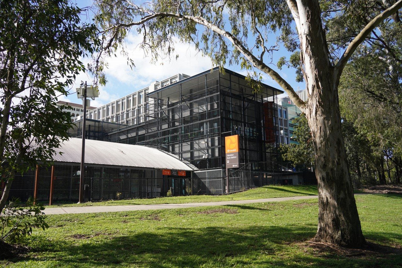
Herston Station(ハーストン駅)は、インナーノーザン・バスウェイにある駅で、ブリスベンメトロM2と多数の路線バスが停車します。周辺には病院や教育機関が集まっており、多くの利用者に利用されています。
この駅の特徴は、ホームや専用道部分がトンネルのような大型のネット構造で覆われていることです。その設置理由については様々な要因が考えられますが、他のバスウェイ駅ではあまり見られない独特な景観を作り出しています。
【追記】ホームページ公開後、現地の方からメールで貴重な情報をお寄せいただきました。隣接するビクトリアパークにはかつて公共ゴルフコースがあり、このネット構造はゴルフボールがバス専用道や停車中のバスに当たるのを防ぐ目的でも設置されたとのことです。情報をご提供いただきありがとうございました。なお、ゴルフコースは2021年に閉鎖され、現在は2032年ブリスベンオリンピック・パラリンピックに向けた再開発が計画されています。
Herston Station is located on the Inner Northern Busway and is served by Brisbane Metro M2 as well as numerous bus routes. The surrounding area includes major hospitals and educational facilities, making the station an important transport hub.
One of the station's most distinctive features is its large tunnel-like mesh structure that covers the platforms and busway. While there may be several reasons for its installation, it creates a striking visual appearance unlike most other busway stations.
Update: After this page was published, a local resident kindly contacted me by email with additional information. The adjacent Victoria Park was formerly a public golf course, and the mesh structure was also intended to prevent golf balls from striking buses or entering the busway. Thank you for sharing this valuable local insight. The golf course closed in 2021, and the area is now planned for redevelopment ahead of the Brisbane 2032 Olympic and Paralympic Games.
Herston駅を過ぎると、インナーノーザン・バスウェイは一般道路との平面交差区間を通過します。
その先ではバスウェイ専用の高架区間に入り、一般道路の上を走行します。地下区間や高架区間など、多様な構造を持つブリスベンのバスウェイ網を象徴する区間のひとつです。
After leaving Herston Station, the Inner Northern Busway passes through a level crossing with a public road.
Beyond this point, the route enters a dedicated elevated busway section above the surrounding roads. It is one of the sections that showcases the diverse infrastructure found across Brisbane's busway network.
M2の終点であるRBWH(Royal Brisbane & Women's Hospital)駅付近では、ブリスベンメトロはバスウェイ専用の高架区間を走行します。
一般道路から完全に分離された高架上を静かに走る電気バスの姿は、ゴムタイヤ式の新交通システムやAGT(Automated Guideway Transit)のようにも見えます。
Near RBWH (Royal Brisbane & Women's Hospital), the northern terminus of M2, Brisbane Metro operates on a dedicated elevated busway.
The sight of electric vehicles travelling along a fully separated elevated guideway can resemble a modern people mover or automated transit system.
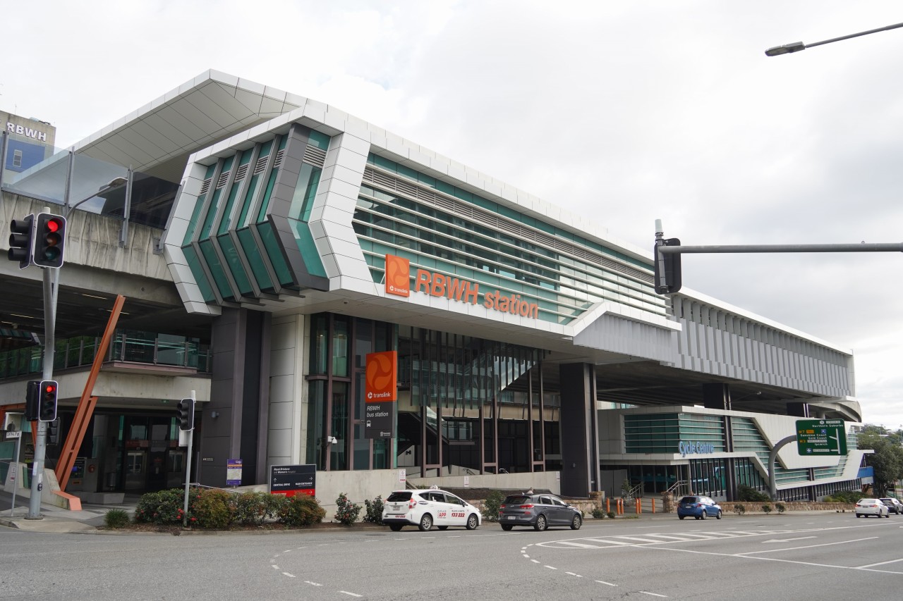
RBWH Station(Royal Brisbane & Women's Hospital駅)は、ブリスベンメトロM2の北側の終点です。駅名の通り、Royal Brisbane & Women's Hospitalに隣接しており、病院利用者や職員の重要な交通手段となっています。
駅はインナーノーザン・バスウェイ上に設けられた高架駅で、大きな屋根を備えた立派な構造が特徴です。その外観は一般的なバス停というよりも鉄道駅に近く、初めて訪れる人にはバスウェイの駅とは思えないほどです。
RBWH Station (Royal Brisbane & Women's Hospital Station) is the northern terminus of Brisbane Metro route M2. As its name suggests, it is located adjacent to the Royal Brisbane & Women's Hospital and provides an important transport link for patients, visitors and hospital staff.
The station is built as an elevated structure on the Inner Northern Busway and features a substantial roof and modern design. Its appearance is more reminiscent of a railway station than a typical bus stop, making it one of the most impressive stations on the busway network.
ブリスベンメトロM2はRBWH(Royal Brisbane & Women's Hospital)駅が終点ですが、インナーノーザン・バスウェイ自体はさらに北へ続いています。Roma Street駅からRBWH駅までは約4km、バスウェイ終点のKedron(ケドロン)駅までは約8kmあります。
Kedron駅から先は専用バスウェイがなくなり、333系統などのバスが一般道路を経由してChermside(チャームサイド)へ向かいます。Roma Street駅からChermsideまでは約11kmです。
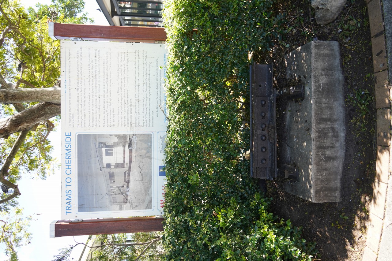
Chermsideはブリスベン北部の主要な商業地区で、チャームサイド・バスターミナル内には、工事中に発掘されたブリスベン市電のレールが解説パネルとともに展示されています。かつてこの地域まで路面電車が運行されていた歴史を今に伝える貴重な展示です。
現在のところブリスベンメトロはRBWH駅までですが、将来的にバスウェイやメトロ網の拡大が進めば、チャームサイド方面まで延伸されることもあるかもしれません。
Brisbane Metro M2 terminates at RBWH (Royal Brisbane & Women's Hospital) Station, but the Inner Northern Busway continues further north. RBWH is approximately 4 km from Roma Street Station, while Kedron Station, the current northern end of the busway, is about 8 km away.
Beyond Kedron, dedicated busway infrastructure ends and routes such as the 333 continue on ordinary roads to Chermside. Chermside is located approximately 11 km from Roma Street.
Inside Chermside Bus Terminal, sections of Brisbane's former tram tracks that were uncovered during construction are displayed alongside information panels. The exhibit provides a reminder that trams once served this part of the city.
Brisbane Metro currently terminates at RBWH, but if future busway and metro expansions proceed, services may one day be extended towards Chermside.
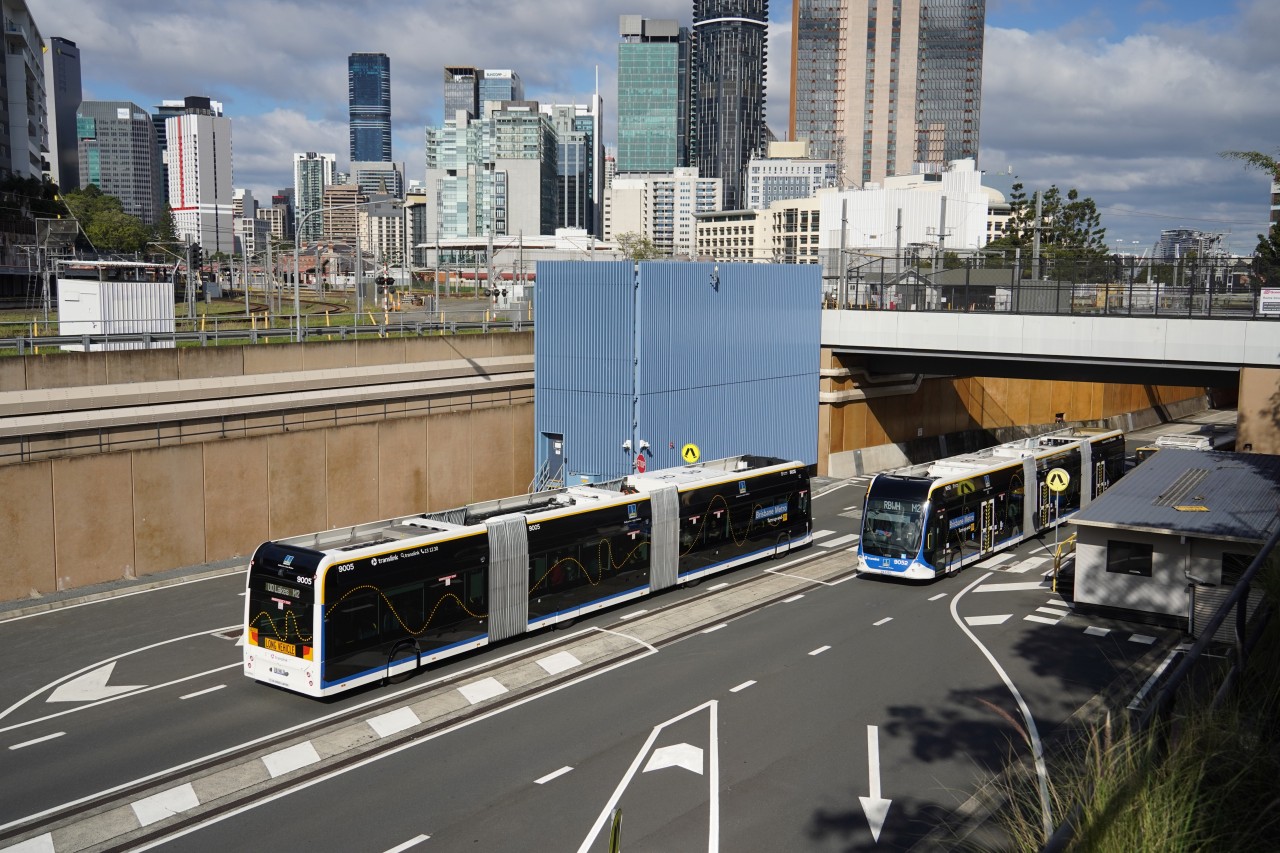
ブリスベンメトロは、専用バスウェイと最新の電気バスを組み合わせた、ブリスベンならではの都市交通システムです。鉄道に匹敵する輸送力を持ちながら、柔軟な路線設定ができることが大きな特徴です。
今後もバスウェイやメトロ網の拡大により、さらに発展していくかもしれません。
ブリスベンの高層ビル群を背景に並走するブリスベンメトロとシティトレインはブリスベンの公共交通を象徴する光景となっています。
Brisbane Metro combines dedicated busways with modern electric buses to create a unique urban transport system for Brisbane. It offers rail-like capacity while maintaining the flexibility of a bus network.
The system may continue to expand in the future as the busway and metro network grow.
Brisbane Metro and Citytrain running against Brisbane's skyline, symbolising the city's public transport network.
